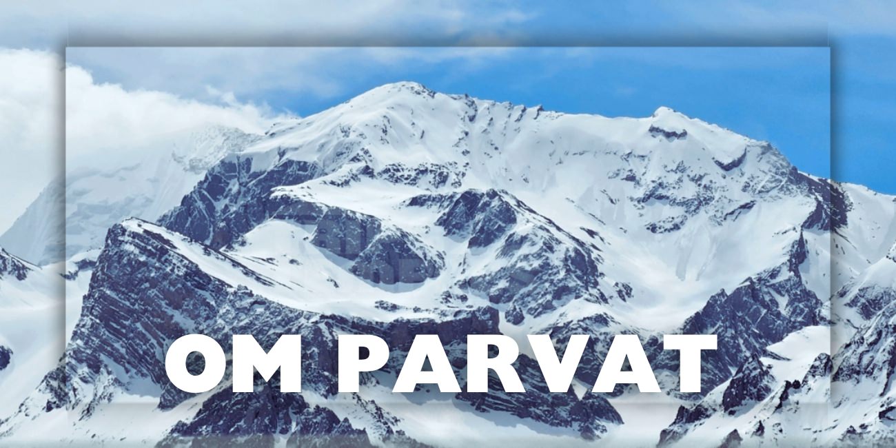
Om Parvat
Om Parvat is a Himalayan peak in Pithoragarh district (Kumaon), Uttarakhand, famous because snow naturally settles on its dark rock face in a pattern that resembles the sacred Hindu symbol “ॐ (Om)”. It lies in a restricted border area near the Lipulekh Pass corridor, so travel is regulated and requires permits.
Where is Om Parvat Located?
Om Parvat is located in Uttarakhand’s Vyas Valley region (Pithoragarh), on/near the traditional Kailash–Mansarovar route toward Lipulekh Pass. The approx. altitude of Om Parvat will be around 5,590 m.
Why Om Parvat Is Famous?
The “ॐ” snow pattern
- The mountain is known for a distinct snow-deposition pattern that appears like ॐ when viewed from the right angle and distance.
- The pattern is seasonal—it’s clearer in some months and may be faint or partly covered depending on snowfall, wind, and temperature.
Spiritual significance
- “Om” (ॐ) is considered the primordial sound/syllable in Hindu traditions, so seeing the symbol in nature is regarded by devotees as highly auspicious.
Where You See Om Parvat From?
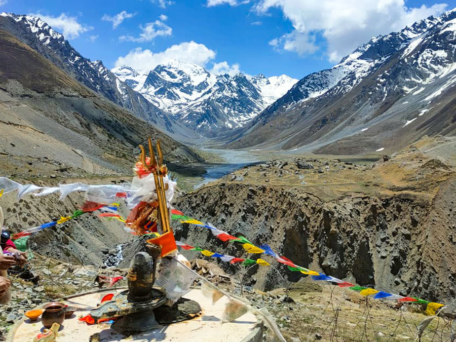
Main viewpoint: Nabhidhang (Nabi Dhang)
Om Parvat is typically viewed from Nabhidhang, a well-known halt on the Lipulekh route. Many travelers doing Adi Kailash Yatra make a diversion via Gunji → Nabhidhang to see Om Parvat.
Permits and Registration for Om parvat Visit
This is a restricted border zone, travelers must obtain an Inner Line Permit (ILP) for movement beyond specified checkpoints. Pithoragarh district administration provides an ILP portal and clearly states ILP is mandatory beyond certain points.
What to keep ready (typical):
- Government photo ID
- Travel dates/plan
- Basic personal details for verification
Note: Exact requirements can change—follow the latest instructions on the official ILP portal.
Best Time to Visit Om Parvat
The usual travel season in this region is late spring to autumn, when roads are more reliable. In winter, the yatra typically shuts due to extreme cold and freezing conditions (permits may stop).
Tip: If your main goal is to see a crisp “ॐ” pattern, plan for a time when there’s enough snow on the face but visibility is also good—cloud and fog are common in the high Himalaya. Last week of May and June are good months to see clear Om on the mountain.
How to Reach
Route Route Map: Kathgodam / Haldwani → Pithoragarh → Dharchula → (permit zone) → Gunji → Nabhidhang (viewpoint)
Road connectivity in the corridor has improved in recent years, including the Dharchula–Lipulekh road project that rises to high altitude and reduces older trekking-only segments.
Om parvat Travel Tips
- Om Parvat viewing involves high altitude and remote terrain. Plan for Acclimatization (headache, nausea, breathlessness can occur)
- Sudden weather changes (snow/rain even in shoulder season), keep clothes and accessories accordingly.
- Limited medical facilities and patchy mobile network
- Carrying ID + permit at all times for checkpoints
- Om Parvat + Adi Kailash Together: Most people combine Om Parvat (darshan from Nabhidhang) with Adi Kailash in the same broader yatra circuit.
Places to see nearby Om Parvat View Point
The main viewpoint to witness the sacred ॐ-shaped snow formation on Om Parvat.
Located on the Lipulekh Pass route.

Adi Kailash (Jolingkong)
Also known as Chhota Kailash, this sacred mountain is associated with Lord Shiva
and is a major pilgrimage destination.

Parvati Tal
A serene high-altitude lake near Adi Kailash, believed to be associated with Goddess Parvati.

Kuti Village
A traditional Himalayan village near the Indo-Tibet border known for its culture
and historical trade routes.

Gunji Village
A key halt point for Adi Kailash and Om Parvat yatras, located at the confluence
of Kali and Kuti rivers.

Kalapani
A sacred site believed to be the origin of the Kali River, featuring an ancient
Shiva temple near the border region.